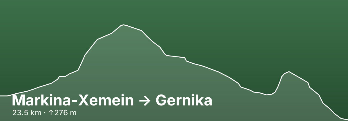
Markina-Xemein → Gernika
A stage of the Camino del Norte
This Camino del Norte stage covers about 23.5 km (guidebooks quote 24–26 km) through the green hill country of inland Bizkaia, with 276 m of ascent and 346 m of descent spread over a string of short, steep climbs rather than one big pass. From Markina a riverside path follows the Artibai to Iruzubieta, then farm lanes lead to Bolibar, the ancestral village of Simón Bolívar's family. A cobbled medieval way and Stations of the Cross climb to the Cistercian monastery of Zenarruza (Ziortza), before a track over the northern flank of Mount Oiz drops to the Lea river and Munitibar, roughly the halfway point. The second half rolls through the hamlets of Aldaka, Olabe and Marmiz on lanes and woodland paths before descending into Gernika-Lumo, the historic seat of the Bizkaian assemblies and the town bombed on 26 April 1937.
- 23.5 kmDistance
- ↑276 m ↓346 mElevation
- ModerateDifficulty
- 87 kmfrom route start
Highlights
- Bolibar: the Simón Bolívar Museum and the twin-towered church of Santo Tomás in the village his ancestors came from
- The medieval stone way and Stations of the Cross climbing to the Zenarruza (Ziortza) collegiate monastery, with its Gothic church, cloister and the eagle-and-skull shield above the entrance arch
- Riverside paths along the Artibai and the Lea, and the Ermita de Santiago on the climb out of Munitibar
- Gernika's Casa de Juntas and the Tree of Gernika, symbols of Basque self-government that survived the 1937 bombing
- The tile replica of Picasso's Guernica on a town street, the Gernika Peace Museum and the Euskal Herria Museoa
Tips
Have breakfast in Markina: the bars in Iruzubieta (km 3.8) are often still closed early, and the next sure stop is Bolibar (km 6.2). The Zenarruza monastery albergue takes no reservations, asks for a donation and includes a shared dinner and breakfast, with Vespers in the church in the evening and a pilgrim blessing after Compline; it is a peaceful alternative to sleeping in Markina. Munitibar (around km 11.5) has a bar, shop, pharmacy and a municipal albergue, and is the best place to restock or split the day. Between Aldaka and Berriondo streams cross the path and it is often muddy, so waterproof footwear helps after rain. Near Olabe and Marmiz you may see old arrows from a former line into town — follow the freshest arrows and wooden posts. In Gernika the volunteer-run pilgrim refuge in the Allende Salazar school opens only in August; the rest of the year rely on private albergues and hostels, and book ahead in summer. Leaving Gernika the next morning there are about 15 km without services, so buy food the evening before.
Towns on this stage
Find accommodation in Gernika →Distances and elevation come from real OpenStreetMap footpath geometry. In the planner you can split or merge any stage to match your pace.