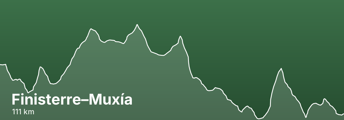
Finisterre–Muxía
Setting out from Santiago de Compostela, this route heads west across the green interior of Galicia toward the Costa da Morte and the Atlantic coast. It passes through the market town of Negreira and the quiet crossroads village of Olveiroa before reaching Fisterra, and many pilgrims add a coastal leg to include the fishing town of Muxía. Waymarking follows the familiar scallop shells and yellow arrows, and it can be walked in either direction or looped to take in both Fisterra and Muxía.
- ~111 kmtotal distance
- 3stages
- ~4-5 days at around 20-28 km/daytypical days
- Late spring to early autumn: May, June, and Septemberbest season
Highlights
- The lighthouse and cape at Cabo Fisterra, the traditional endpoint on the Atlantic
- Negreira as the first main stage stop after leaving Santiago
- Olveiroa, a small stone hamlet and a natural rest point on the inland stretch
- The optional coastal spur to Muxía and its seaside sanctuary of A Barca
- Long, peaceful stretches through Galician woodland, farmland, and hamlets
Stages
| # | Stage | Distance | Elevation | Difficulty |
|---|---|---|---|---|
| 1 | Santiago de Compostela → Negreira · guide → | 19.8 km | ↑152 ↓202 m | Moderate |
| 2 | Negreira → Olveiroa · guide → | 30.8 km | ↑291 ↓196 m | Moderate |
| 3 | Olveiroa → Fisterra · guide → | 60.3 km | ↑427 ↓679 m | Challenging |
Rolling terrain over woodland tracks, quiet country roads, and rural paths, with some ups and downs but no sustained mountain climbing.
Distances and elevation come from real OpenStreetMap footpath geometry. In the planner you can split or merge any stage to match your pace.
Where to stay — Finisterre–Muxía
- Negreira 9 albergues · 4 hotels · book
- Olveiroa 6 albergues · 2 hotels · book
- Fisterra 15 albergues · 13 hotels · book
Frequently asked questions
How long is the Finisterre–Muxía?
About 111 km, usually walked in 3 stages (~4-5 days at around 20-28 km/day).
When is the best time to walk the Finisterre–Muxía?
Late spring to early autumn: May, June, and September
How hard is the Finisterre–Muxía?
Rolling terrain over woodland tracks, quiet country roads, and rural paths, with some ups and downs but no sustained mountain climbing.