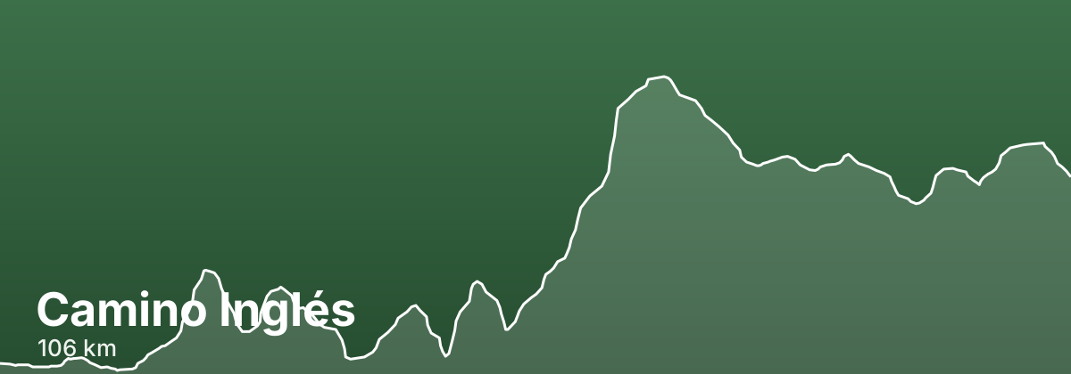
Camino Inglés
Beginning at the naval port of Ferrol on Galicia's northern coast, the Camino Inglés threads inland through green hills, tidal estuaries and eucalyptus woods before reaching Santiago. Because it comfortably clears the 100 km minimum, it draws pilgrims who want a shorter, quieter route that still earns the Compostela, passing through the old towns of Pontedeume and Betanzos and the rural crossroads of Hospital de Bruma. Waymarking and pilgrim infrastructure are well established, though services are more spread out than on the busier Camino Francés.
- ~106 kmtotal distance
- 5stages
- ~5-6 days at roughly 20-25 km/daytypical days
- Late May to June, Septemberbest season
Highlights
- Ferrol's waterfront and old town as the traditional starting point
- The medieval bridge and arcaded streets of Pontedeume
- Betanzos, with its historic old quarter and hilltop churches
- Hospital de Bruma, a quiet inland waypoint where the Ferrol and A Coruña routes converge
- The final approach into Santiago and its cathedral, shared with pilgrims from every Camino
Stages
| # | Stage | Distance | Elevation | Difficulty |
|---|---|---|---|---|
| 1 | Ferrol → Pontedeume · guide → | 25.5 km | ↑166 ↓113 m | Moderate |
| 2 | Pontedeume → Betanzos · guide → | 18.6 km | ↑132 ↓175 m | Moderate |
| 3 | Betanzos → Hospital de Bruma · guide → | 16.9 km | ↑402 ↓68 m | Moderate |
| 4 | Hospital de Bruma → Sigüeiro · guide → | 28.9 km | ↑98 ↓209 m | Moderate |
| 5 | Sigüeiro → Santiago de Compostela · guide → | 16.1 km | ↑109 ↓78 m | Easy |
The terrain is rolling rather than mountainous, but expect steady climbs and descents leaving the estuaries, and the long stage up to Hospital de Bruma is one of the more demanding sections.
Distances and elevation come from real OpenStreetMap footpath geometry. In the planner you can split or merge any stage to match your pace.
Where to stay — Camino Inglés
- Pontedeume 2 albergues · 14 hotels · book
- Betanzos 3 albergues · 5 hotels · book
- Hospital de Bruma · book
- Sigüeiro 4 albergues · 2 hotels · book
- Santiago de Compostela 21 albergues · 40 hotels · book
Frequently asked questions
How long is the Camino Inglés?
About 106 km, usually walked in 5 stages (~5-6 days at roughly 20-25 km/day).
When is the best time to walk the Camino Inglés?
Late May to June, September
How hard is the Camino Inglés?
The terrain is rolling rather than mountainous, but expect steady climbs and descents leaving the estuaries, and the long stage up to Hospital de Bruma is one of the more demanding sections.