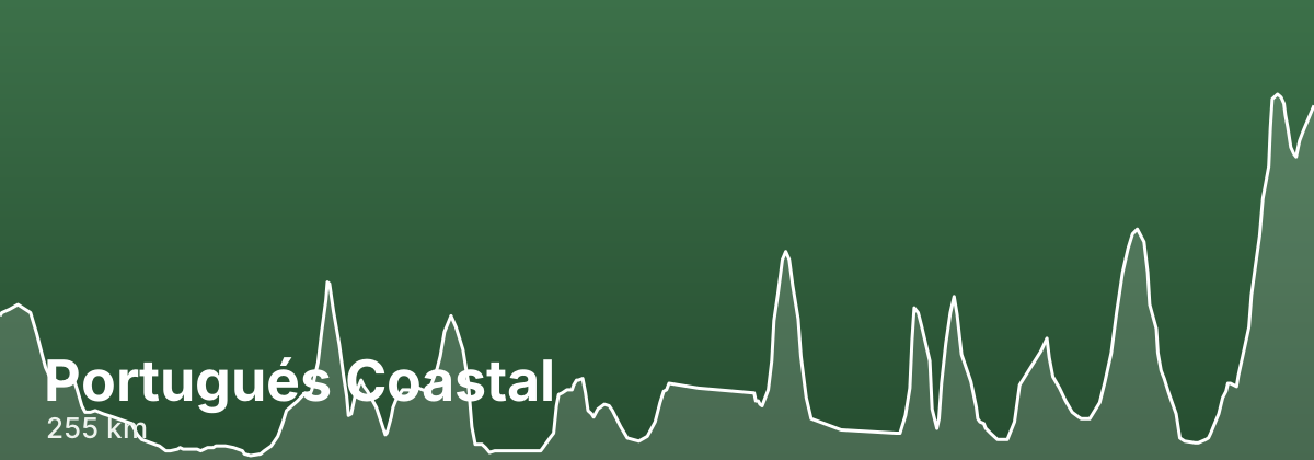
Portugués Coastal
Beyond the seafront boardwalks, the Coastal Portuguese Way threads together working fishing towns, river estuaries, and Galician rías, giving the walk a distinctly maritime character. The route crosses from Portugal into Spain near the mouth of the Minho, then turns inland at Redondela to share waymarking and stage towns with the Central route on the final push to Santiago. It is well served by albergues, pensions, and hotels throughout, making it one of the more flexible Camino routes for planning daily distances.
- ~255 kmtotal distance
- 12stages
- ~12 days at ~20-25 km/daytypical days
- Late May to June, and Septemberbest season
Highlights
- The hilltop Santa Luzia sanctuary overlooking Viana do Castelo and its estuary
- Crossing the Minho river from Caminha into Spain by ferry, arriving at A Guarda
- The harbour town of Baiona and the seafood of the Galician rías around Vigo
- Pontevedra's well-preserved medieval old town, a natural rest stop before the final stages
- Padrón, tied to the Saint James tradition, on the approach to Santiago
Stages
| # | Stage | Distance | Elevation | Difficulty |
|---|---|---|---|---|
| 1 | Porto → Vila do Conde · guide → | 26.9 km | ↑11 ↓88 m | Moderate |
| 2 | Vila do Conde → Esposende · guide → | 23.6 km | ↑7 ↓16 m | Easy |
| 3 | Esposende → Viana do Castelo · guide → | 25.1 km | ↑145 ↓127 m | Moderate |
| 4 | Viana do Castelo → Caminha · guide → | 24.9 km | ↑73 ↓89 m | Moderate |
| 5 | Caminha → A Guarda · guide → | 0.9 km | ↑0 ↓0 m | Easy |
| 6 | A Guarda → Baiona · guide → | 44.8 km | ↑99 ↓63 m | Moderate |
| 7 | Baiona → Vigo · guide → | 11.6 km | ↑99 ↓121 m | Easy |
| 8 | Vigo → Redondela · guide → | 16 km | ↑0 ↓3 m | Easy |
| 9 | Redondela → Pontevedra · guide → | 19.3 km | ↑163 ↓166 m | Moderate |
| 10 | Pontevedra → Caldas de Reis · guide → | 20.1 km | ↑76 ↓54 m | Easy |
| 11 | Caldas de Reis → Padrón · guide → | 17.8 km | ↑108 ↓134 m | Easy |
| 12 | Padrón → Santiago de Compostela · guide → | 23.7 km | ↑254 ↓43 m | Moderate |
Terrain stays largely flat and low along the coast, so the main challenges are long exposed stretches in wind or sun rather than steep climbs.
Distances and elevation come from real OpenStreetMap footpath geometry. In the planner you can split or merge any stage to match your pace.
Where to stay — Portugués Coastal
- Vila do Conde 6 albergues · 9 hotels · book
- Esposende 2 albergues · 7 hotels · book
- Viana do Castelo 5 albergues · 24 hotels · book
- Caminha 3 albergues · 8 hotels · book
- A Guarda 3 albergues · 8 hotels · book
- Baiona 2 albergues · 5 hotels · book
- Vigo 1 albergues · book
- Redondela 11 albergues · 4 hotels · book
- Pontevedra 10 albergues · 17 hotels · book
- Caldas de Reis 10 albergues · 12 hotels · book
- Padrón 11 albergues · 11 hotels · book
- Santiago de Compostela 21 albergues · 40 hotels · book
Frequently asked questions
How long is the Portugués Coastal?
About 255 km, usually walked in 12 stages (~12 days at ~20-25 km/day).
When is the best time to walk the Portugués Coastal?
Late May to June, and September
How hard is the Portugués Coastal?
Terrain stays largely flat and low along the coast, so the main challenges are long exposed stretches in wind or sun rather than steep climbs.